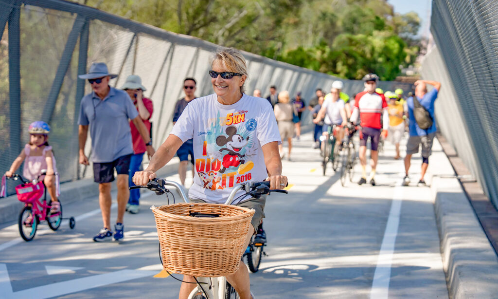
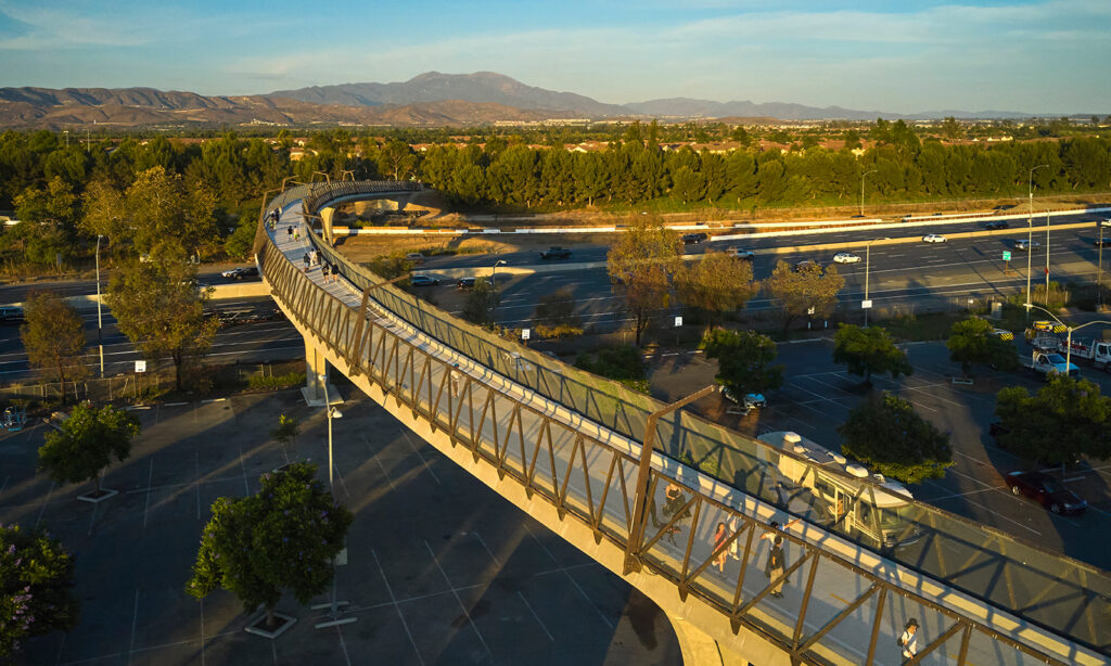
When the city of Irvine celebrated the grand opening of the 1,200-foot Jeffrey Open Space Trail Bicycle & Pedestrian Bridge, it marked more than a new crossing over the busy 5 freeway to avoid surface streets. It signaled a significant expansion to Irvine’s trail and bike path system. A trail that mainly served North Irvine soon will become a continuous greenbelt connecting across the city.
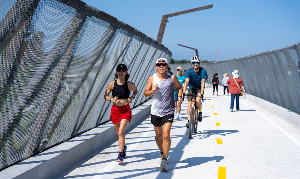
As the ribbon fell, local runners, cyclists and families stepped onto the sweeping span to experience their first trip across. Oak Creek resident Jay Sato’s first impression? “The fact that the bridge is curved is amazing.” Sato says he “can’t wait to ride it at night when the bridge lights are on.”
For Woodbridge resident Cheryl Evans, the opening of the new bridge was decades in the making. “I’ve been waiting for this for 25 or 30 years,” Evans says. A former Woodbridge High School cross-country coach for more than 20 years, she recalls how local runners once had to navigate old orange groves. “Having a safe crossing over the freeway enlarges the area where we can go. You’re always looking for safe places for kids to run, and when you have distance runners, you need a good, safe 10 miles or so.”
Expanding access
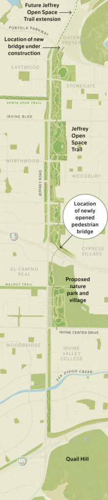
The new bridge is only one piece of a rapidly developing regional network that will soon offer cross-country runners even more room to run. Just north of the new span, construction has begun on another key link: a dedicated pedestrian and cycling bridge over Portola Parkway at Jeffrey Road. Over the next 18 months, this bridge will extend Jeffrey Open Space Trail across Portola Parkway, directly into the Gateway Open Space Preserve, giving outdoor enthusiasts access to 20,000 acres of protected northern foothills, including Limestone, Fremont and Black Star canyons.
“What a great addition,” says Jon White of Turtle Rock, who was the third cyclist on the new bridge. He is already looking forward to the upcoming extensions. “With another few sections, it will be a quick ride north and south through the city.”
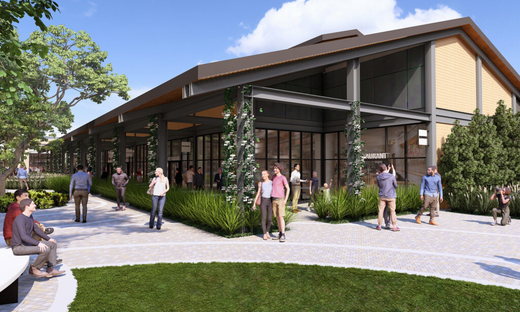
The proposed Oak Creek nature park and village plan promises to complete the trail’s missing middle. The plan envisions converting the privately owned golf course into more than 50 acres of public meadows, botanical gardens and restored riparian woodlands complete with 5 miles of new trails. The plan also introduces two new elevated bridges – spanning Irvine Center Drive and the railroad tracks at Walnut Trail – allowing trail users to navigate central Irvine separated from vehicular traffic.
Farther south, the trail connects to the existing pedestrian bridge over the 405 freeway into Quail Hill. That southern anchor already links travelers directly into the 20,000-acre South Coast Wilderness, guiding hikers and bikers toward Laguna Coast Wilderness Park, Crystal Cove State Park and Upper Newport Bay. It also connects to UC Irvine via Sand Canyon Wash Trail and Mason Regional Park.
“Having a safe crossing over the freeway enlarges the area where we can go. You’re always looking for safe places for kids to run, and when you have distance runners, you need a good, safe 10 miles or so.”
Cheryl Evans, former Woodbridge High School cross-country coach
Long-term vision
This continuity is the realization of a decades-long master-planned vision shared by the city of Irvine and Irvine Company. From its initial stretch featuring historic timeline panels embedded in the pavement, Jeffrey Open Space Trail was designed around community feedback and a commitment to protect more than 57,500 acres of preserved open space as well as a commitment to safety.
That promise of safety and continuity resonates across generations of local athletes. Northwood resident Traci Maynard, an assistant cross-country coach at Beckman High School and founder of the Flying Eagles OC youth running club, brought her young athletes to cross the new span on opening day. As an avid cyclist and runner, Maynard emphasizes how crucial a seamless trail network is for training.
“Signals are very dangerous, especially those right turners,” Maynard says, noting the value of existing bridges and tunnels along the trail. “We’ve always gone north on the trail, and now we can go south because of this new bridge. I can’t wait until it connects with the nature park.”
Evans echoed the sentiment, praising the dual dirt-and-concrete running surfaces, flat terrain and mature trees that provide natural shade during long training runs, calling Irvine’s trail infrastructure “priceless.”
Once the Portola and Oak Creek bridges are complete, residents will be able to commute, train or stroll across the entire length of Irvine – from the preserved open spaces in the mountains down to the Pacific coastline – on a unified, world-class trail.
Irvine’s Pedestrian Bridges
1985: Ray Watson Bridge at UC Irvine spans Campus Drive to link the UCI campus to University Center
2003: 405 freeway/Quail Hill overcrossing spans the freeway near Jeffrey Road, linking to Quail Hill Open Space
2015: Jeffrey Open Space Trail northern bridges Grade-separated crossings spanning Irvine Boulevard, Trabuco Road and Bryan Avenue
2016: Great Park pedestrian bridge crosses Irvine Boulevard at Ridge Valley
2022: Venta Spur Trail bridge spans the 133 toll road to connect the trail to the Great Park area
2026: Jeffrey Open Space Trail/5 freeway pedestrian bridge spans over Walnut Avenue and the 5 freeway
Under Construction: Jamboree & Michelson pedestrian bridge will cross Jamboree Road to link Park Place with Irvine Business Center
Under Construction: Jeffrey Open Space Trail/Portola Parkway will connect JOST to Gateway Preserve
Proposed: Oak Creek nature park bridges would carry Jeffrey Open Space Trail over rail lines and Irvine Center Drive within the new nature park